
-
Challenging
-
Excellent Fitness Required
-
4,860 m / 15,945 ft
-
Huaraz
-
15+
-
April - December
-
Spanish / English
-
Private / Shared Groups (5-10)
Alpamayo Trek Peru - 9 Days
The Alpamayo Trek Peru – 9 Days is one of the most complete high altitude trekking experiences in the Cordillera Blanca. This remote circuit is designed for experienced hikers seeking dramatic landscapes, challenging mountain passes and a deeper connection with the Andes.
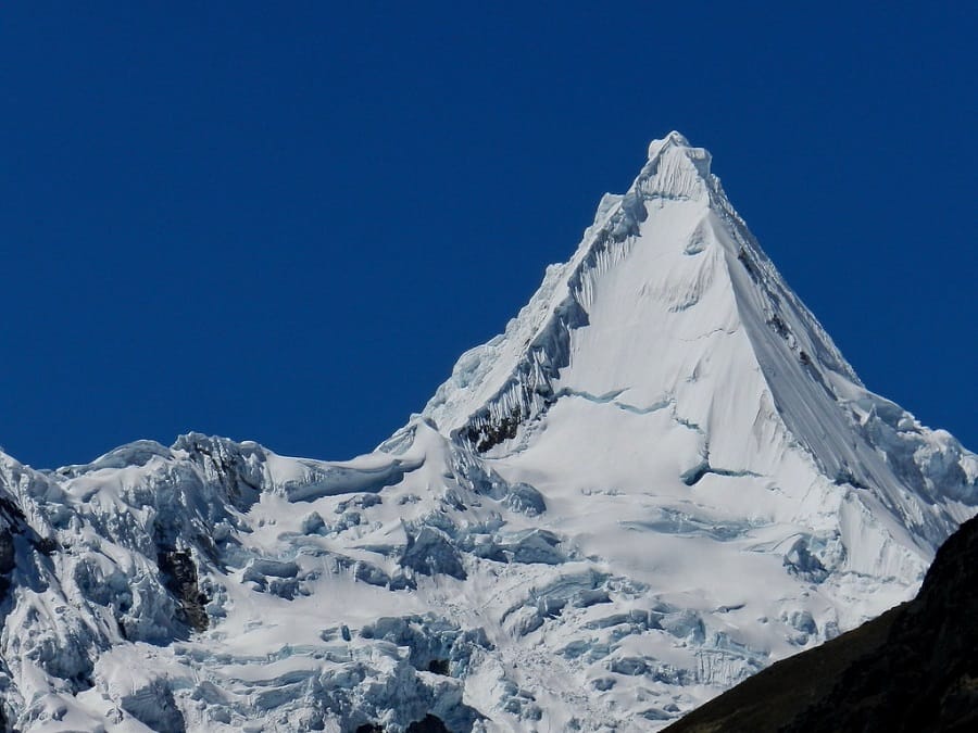
The route crosses iconic passes including Punta Union, Pucajirca, Yanacon, Caracara and Cullicocha, while exploring remote valleys, glacial lakes and traditional Andean landscapes. One of the main highlights is reaching the Jancarurish sector, where the legendary pyramid-shaped Alpamayo becomes the symbol of the journey.
With professional mountain staff, complete camping logistics and safety support, Exploria offers an authentic expedition through one of Peru’s most spectacular trekking circuits.
Why Choose This Trek?
- Discover the Legendary Alpamayo Region Beyond the Classic Treks
- Cross Remote High Andean Passes Through the Heart of the Cordillera Blanca
- Experience Iconic Views of Alpamayo from the Jancarurish Valley
- Explore Turquoise Lakes, Glacial Landscapes and Remote Mountain Valleys
- Enjoy a True Expedition Style Trekking Experience in Peru
Itinerary
A spectacular 9 day Alpamayo circuit trek through Peru's Cordillera Blanca, crossing remote high mountain passes, turquoise glacial lakes and isolated valleys with unforgettable views of Alpamayo and surrounding peaks.
We leave Huaraz in the morning by private transport and travel north through the Callejon de Huaylas toward the Llanganuco Valley. The road passes the turquoise Chinancocha and Orconcocha lakes before climbing toward Portachuelo, one of the finest road-access viewpoints in the Cordillera Blanca.
After crossing Portachuelo, we descend toward Vaqueria, where the trekking section begins. From here, we hike through rural Andean landscapes and enter the Huaripampa Valley before continuing to our first camp in the Paria area.
This first day combines an impressive scenic drive with a moderate introductory hike and helps the group settle into the rhythm of the expedition.
- Huaraz altitude: Approximately 10,171 ft
- Llanganuco Lakes: Approximately 12,795 ft
- Portachuelo: Approximately 15,617 ft
- Paria camp: Approximately 12,467-13,058 ft
- Hiking time: Approximately 5-6 hours
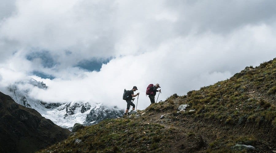
After breakfast, we begin the ascent toward Punta Union Pass, one of the classic high points of the Cordillera Blanca trekking network. The trail climbs steadily through increasingly alpine terrain as the surrounding mountains and valleys open below us.
At approximately 15,584 ft, Punta Union provides a dramatic panorama of the surrounding peaks, glacial terrain and high mountain lakes. After a break at the pass, we descend toward the Tuctubamba sector and our campsite.
This is a demanding but highly rewarding mountain day and an important transition toward the more remote stages of the Alpamayo circuit.
- Maximum altitude: Approximately 15,584 ft at Punta Union Pass
- Camp altitude: Approximately 13,780 ft at Tuctubamba
- Hiking time: Approximately 6-7 hour
We continue deeper into the Cordillera Blanca with a steady climb toward Pucajirca Pass. The route gains altitude through high-Andean grasslands and increasingly open mountain terrain.
From the pass, the landscape expands toward the Pucajirca and surrounding mountain groups. After enjoying the high-altitude views, we begin the descent toward Quisuar, passing through quieter valleys with native vegetation and small alpine lakes along the way.
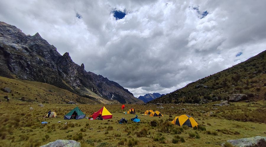
We reach camp at Quisuar in the afternoon, completing another demanding crossing in a remote section of the range.
- Maximum altitude: Approximately 15,223 ft at Pucajirca Pass
- Camp altitude: Approximately 12,795 ft at Quisuar
- Hiking time: Approximately 6-7 hours
Today we climb from Quisuar toward Tupatupa Pass. The ascent leads through a broad Andean landscape where the route feels increasingly isolated from the better-known trekking corridors of the Cordillera Blanca.
At approximately 14,436 ft, Tupatupa Pass offers a wide view over the surrounding valleys before we begin a long descent toward Jancapampa.
As we lose altitude, the scenery becomes greener and more pastoral. The Jancapampa area provides an opportunity to experience the human side of the Andes, with traditional settlements and agricultural landscapes appearing again after the high mountain crossing.
- Maximum altitude: Approximately 14,436 ft at Tupatupa Pass
- Camp altitude: Approximately 11,811 ft at Jancapampa
- Hiking time: Approximately 6-7 hours
We leave Jancapampa and begin another sustained climb toward Yanacon Pass. The route gradually leaves the inhabited valley behind and returns to high-altitude terrain.
At approximately 15,092 ft, the pass opens views toward remote valleys and the snow-covered peaks of the northern Cordillera Blanca. The crossing requires a steady pace and good acclimatization.
From Yanacon, we descend toward Huillca, where we spend the night in a quiet mountain camp surrounded by open Andean scenery.
- Maximum altitude: Approximately 15,092 ft at Yanacon Pass
- Camp altitude: Approximately 13,123 ft at Huillca
- Hiking time: Approximately 7 hours
This is one of the strongest mountain days of the trek, with two significant passes to cross before reaching the Alpamayo sector.
We first climb toward Mesapata Pass and continue through rugged high-altitude terrain toward Caracara Pass. At approximately 15,846 ft, Caracara is one of the highest points of the entire itinerary and rewards the effort with extensive mountain views.
After the pass, we descend toward Jancarurish. As we approach camp, Alpamayo becomes the dominant landmark and the surrounding valley offers one of the most memorable settings of the trek.
- Mesapata Pass: Approximately 14,633 ft
- Caracara Pass: Approximately 15,846 ft
- Jancarurish camp: Approximately 13,780 ft
- Hiking time: Approximately 7-8 hours
Waking up in Jancarurish is one of the highlights of the expedition, with the Alpamayo massif rising above the surrounding valley. After breakfast, we continue across the remote Cedros sector toward Vientunan Pass.
The trail climbs through high mountain terrain to approximately 15,650 ft before descending toward Osoruri. Throughout the day, the changing perspective reveals remote valleys, glacial landscapes and impressive views across the northern Cordillera Blanca.
We camp at Osoruri at approximately 14,928 ft. An additional hike to the Alpamayo viewpoint can be arranged, but it requires adding an extra day to the standard 9-day program.
- Maximum altitude: Approximately 15,650 ft at Vientunan Pass
- Camp altitude: Approximately 14,928 ft at Osoruri
- Hiking time: Approximately 5-7 hours
From Osoruri, we begin a demanding high-altitude day toward Cullicocha Pass, the highest point of the trek at approximately 15,945 ft.
The crossing offers outstanding views of the northern Cordillera Blanca. We then descend toward the striking turquoise waters of Cullicocha Lake, located at approximately 15,157 ft and surrounded by dramatic mountain scenery.
After spending time near the lake, we continue descending toward Huishcash, where we establish our final camp and enjoy the changing landscape as the expedition approaches its conclusion.
- Maximum altitude: Approximately 15,945 ft at Cullicocha Pass
- Cullicocha Lake: Approximately 15,157 ft
- Camp altitude: Approximately 13,780 ft at Huishcash
- Hiking time: Approximately 6-7 hours
Our final trekking day begins with a descent from Huishcash toward Hualcayan. After days of high passes, glacial landscapes and remote camps, the terrain becomes progressively greener and signs of everyday Andean life reappear.
Reaching Hualcayan marks the end of the walking section of the Alpamayo Trek. Our private vehicle will be waiting for the return journey to Huaraz.
The drive back offers time to reflect on the major crossings, remote camps, turquoise lakes and views of Alpamayo that make this one of the great trekking journeys of the Cordillera Blanca.
- Hualcayan altitude: Approximately 10,335 ft
- Huaraz altitude: Approximately 10,171 ft
- Hiking time: Approximately 3-4 hours
- Return: Private transfer to Huaraz
What's Included & Not Included
What's Included
- Certified Mountain Guide
- Mountain Staff (Cook, Assistant & Muleteers)
- Private Transportation
- Pack Animals for Equipment & Personal Luggage
- Emergency Horse Support
- Huascarán National Park Entrance Fee
- Full Board During the Trek
- Camping Equipment (Personal Tents, Dining Tent & Kitchen Tent)
- Sleeping Equipment (Sleeping Bag & Sleeping Mat)
- Private Toilet Tent
- First Aid Kit & Emergency Oxygen
- Communication & Navigation Equipment (Radios, GPS & Maps)
- Satellite Phone (Available Upon Request)
Not Included
- International & Domestic Flights
- Accommodation in Huaraz
- Meals in Huaraz before and after the trek
- Travel Insurance (high-altitude trekking, rescue and evacuation coverage)
- Personal Trekking Gear
- Tips and Personal Expenses
- Additional services or expenses not mentioned in the itinerary
Alpamayo Base Camp Trek FAQs
General
This trek is rated moderate to challenging, with several consecutive days at high altitude and multiple mountain passes above 14,000 ft.
Good cardiovascular fitness, strong legs and previous multi-day hiking experience are highly recommended. The most demanding stages include the Caracara and Cullicocha crossings.
Yes. Proper acclimatization is essential for this itinerary. We recommend spending at least two to three days in Huaraz before departure and completing one or more acclimatization hikes before beginning the 9-day trek.
No. This is a trekking program through the valleys and high passes surrounding the Alpamayo region. It does not include a technical ascent of Alpamayo. Travelers looking to climb the mountain should choose a dedicated Alpamayo mountaineering expedition.
The Jancarurish sector offers some of the most memorable views of Alpamayo during the trek.
An additional hike to a dedicated Alpamayo viewpoint can also be arranged, but the current itinerary notes that this requires adding an extra day to the standard 9-day program.
The highest point of the itinerary is approximately 15,945 ft at Cullicocha Pass.
Several other passes are above 15,000 ft, including Punta Union, Pucajirca, Yanacon, Caracara and Vientunan.
Exploria lists the operating season from April through December. The drier months generally provide the most favorable conditions for multi-day trekking in the Cordillera Blanca.
Conditions can vary from year to year, so the final route and departure should always be evaluated according to current mountain weather and trail conditions.
No. Altitudes and hiking times are approximate and may vary depending on the exact campsite, group pace, weather and current trail conditions.